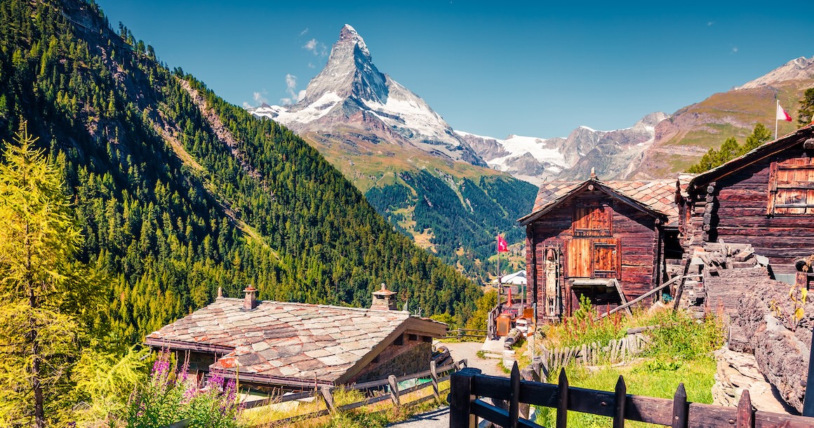
Italy & Switzerland | Matterhorn Trek
Explore a spectacular alpine world in the highest mountains in Western Europe


Trip Highlights:
-
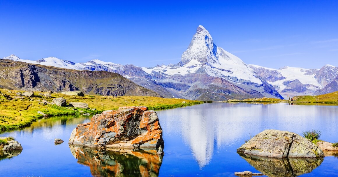
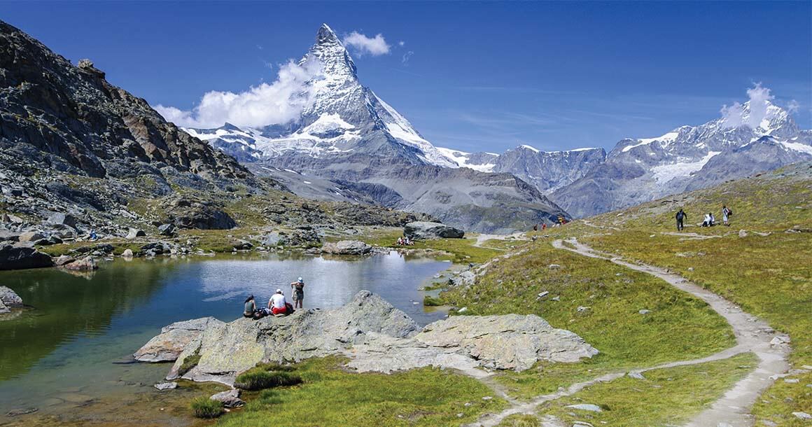
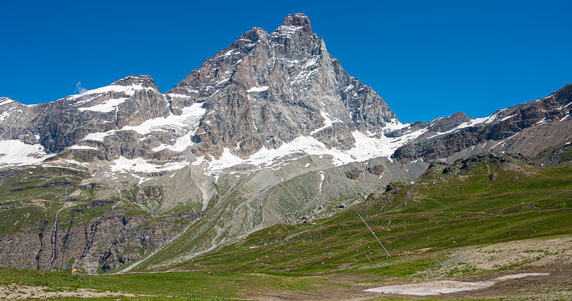
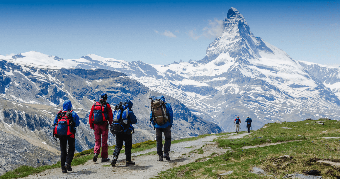
Explore the Matterhorn, the most iconic mountain in the world.
-
Circumnavigate Monte Rosa, the Alps’ second highest peak.
-
Trek from Cervinia, Italy to Zermatt, Switzerland.
-
Visit medieval hamlets with cobbled streets and authentic shops and restaurants.
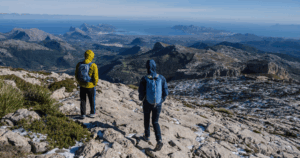
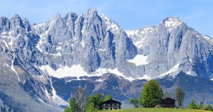
The highest mountains in western Europe, the Pennine Alps, offer a sensational opportunity for hikers to explore a spectacular alpine world.
This itinerary starts and finishes beneath the Matterhorn, the most iconic peak in the world, and circumnavigates the Monte Rosa, the Alps’ second highest peak. The Tour Monte Rosa has become a much sought after achievement in recent years, and our itinerary follows much of the same route. In Macugnaga we are treated to perhaps the Alps’ most spectacular mountain view, the East Face of the Monte Rosa, which is truly Himalayan in proportion, at 10,000 feet above the valley floor.
Ryder-Walker offers the Matterhorn Trek from Cervina to Zermatt in a nine day trip. This is a rare tour where the level of the challenge is equalled by the comfort of the accommodations. Along the way, we use the finest accommodations, all but one are four star, and some are truly exceptional. Luggage is transported every night, so you can go light and enjoy the mountains without the encumbrance of a heavy backpack. Hiking days are challenging, but the scenery is breathtaking, and at the end of the day a comfortable bed, hot shower, good meal, glass of local wine or beer, and the company of other hikers awaits.
Begin in Breuil-Cervinia, an Alpine resort town in the Valle d’Aosta region of northwest Italy. Continue east through small villages in very remote valleys. In Italy they are the Valtournenche, Val d’Ayas, the Valle di Gressoney, the Valsesia, and the Valle Anzasca. In Switzerland you visit the Saastal and Mattertal.
This is truly a remote outing, and it is possible on many days that you will not see any other hikers. About two thousand years ago, Walsers, one of Europe’s wildest ethnicities also settled in these valleys. To this day their distinct architecture is fascinating and beautiful.
The villages visited are truly charismatic. Champoluc and Gressoney are medieval hamlets with cobbled streets and odd shops and restaurants. Alagna defies description and seems time forgotten. Macugnaga is a Walser “capital” of sorts, and enjoys an absolutely magnificent setting. Saas Fee, the “Pearl of the Alps”, rests on a bench high above the valley, beneath the Dom (the highest peak entirely in Switzerland), and many square miles of glaciers seem to cascade straight into town. Zermatt rests at the foot of the Matterhorn and is the Alps’ liveliest and most captivating town. This is a challenging trek with rewards that are unsurpassed.
Trip Elevation

Trip Itinerary
Choose from our standard itinerary or customize the trek by adding or subtracting days.
Ryder-Walker will provide a taxi transfer from Chivasso Train Station to the hotel in Breuil-Cervinia. Check in to your welcoming hotel in this alpine resort in the Valle d’Aosta region of northwest Italy located directly under the South face of the Matterhorn.
This is a great, moderate day hike starting from tiny Cheniel. Ascend to the Col di Nana beneath the Grand Tournalin, and descent to the idyllic hamlet of St. Jacques. Continue on to the hamlet of Mascognaz, high above Champoluc and overnight in one of the finest hotels in the Alps.
Distance: 7.5 miles. Elevation gain/loss: 3000/3560 ft.
This is a more challenging hike, crossing over to Gressoney. Climb to the herder’s settlement of Cuneaz, and ascend from there to the Pentacol and the Col Pinter with sweeping views from the Grand Combin to Mount Blanc—and rare sights of the Matterhorn’s southwest face. Enter the Walser heartland of Val di Gressoney beneath the towering Lyskamm, and walk past ancient Walser farms to our excellent hotel in town.
Distance: 8.5 miles. Elevation gain/loss: 3400/4000 ft.
You begin with a short bus ride east out of town. Today will be another longer and challenging day hike. After crossing out of the Val d’ Aosta and into the realm of Val Sesia, your descent can include the wonderful Val d’ Otro featuring many authentic and well cared for historic farming villages.
Distance: 11 miles. Elevation gain/loss: 2100/5900 ft.
Alternate Route: 8 miles. Elevation gain/loss: 415/5900 ft.
Hike over the magnificent Turlo Pass, the scene of many WWI battles. Follow a Roman road to the historic village of Macugnaga, nestled beneath the staggering 10,000 ft east face of the Monte Rosa. Overnight in a charming three-star hotel in the center of the village.
Distance: 14 miles. Elevation gain/loss: 4000/5000 ft.
This spectacular day hike crosses from Italy’s Val Anzasca into Switzerland’s Saastal, beginning with a cable car ride to near the Monte Moro Pass. You enter Swiss territory beneath the famed Madonna della Nevi statue, then descend to and circle the beautiful Mattmark reservoir. From there, either hike or take the Swiss Postbus to the picturesque village of Saas-Almagell, continuing on to Saas-Fee. Overnight in an outstanding hotel in the heart of this charming village.
Distance: 6 miles. Elevation gain/loss: 900/2500 ft.
Optional extension: +3 miles. Elevation gain/loss: 900/4000 ft.
Today’s spectacular alpine route—known as the Hohenweg—offers sweeping, unobstructed views of the Mischabel range, including the Dom, one of the highest peaks in the Alps. Enjoy hiking high alpine slopes as you pass through rocky outcrops, meadows, and sections of narrow path with some exposure. End the day with a dramatic and rewarding route above the Saas Valley. Transfer to Zermatt for the night.
Distance: 7 miles. Elevation gain/loss: 700/3000 ft.
The lake of Schwarzsee is iconic – its position just below the Hornli ridge of the Matterhorn makes for a dramatic finish to your trek. Today’s hike begins directly out of Zermatt, passing ancient barns en route to the charming village of Zmutt. Enjoy a picnic under the North Face of the Matterhorn before climbing to Schwarzsee. Return to Zermatt is via the Matterhorn Express cable car.
For a shorter day, end in Furi and catch the Matterhorn Express back to Zermatt.
Distance: 6 miles. Elevation gain/loss: 3500/500 ft.
Optional easiwer rrout: Distance: 4 miles. Elevation gain/loss: 1500/600 ft.