France, Italy & Switzerland | Tour du Mont Blanc
Circumnavigate Western Europe's highest peak.


Trip Highlights:
-
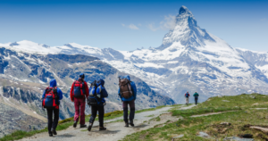
A world famous hike that everybody should do at least once.
-
Hiking beneath Mont Blanc, Western Europe’s highest peak.
-
The pleasures of France, Italy and Switzerland all in one tour.
Outside Magazine named Ryder-Walker’s trek one of the 25 Best Hikes in the World.
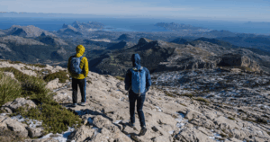
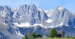
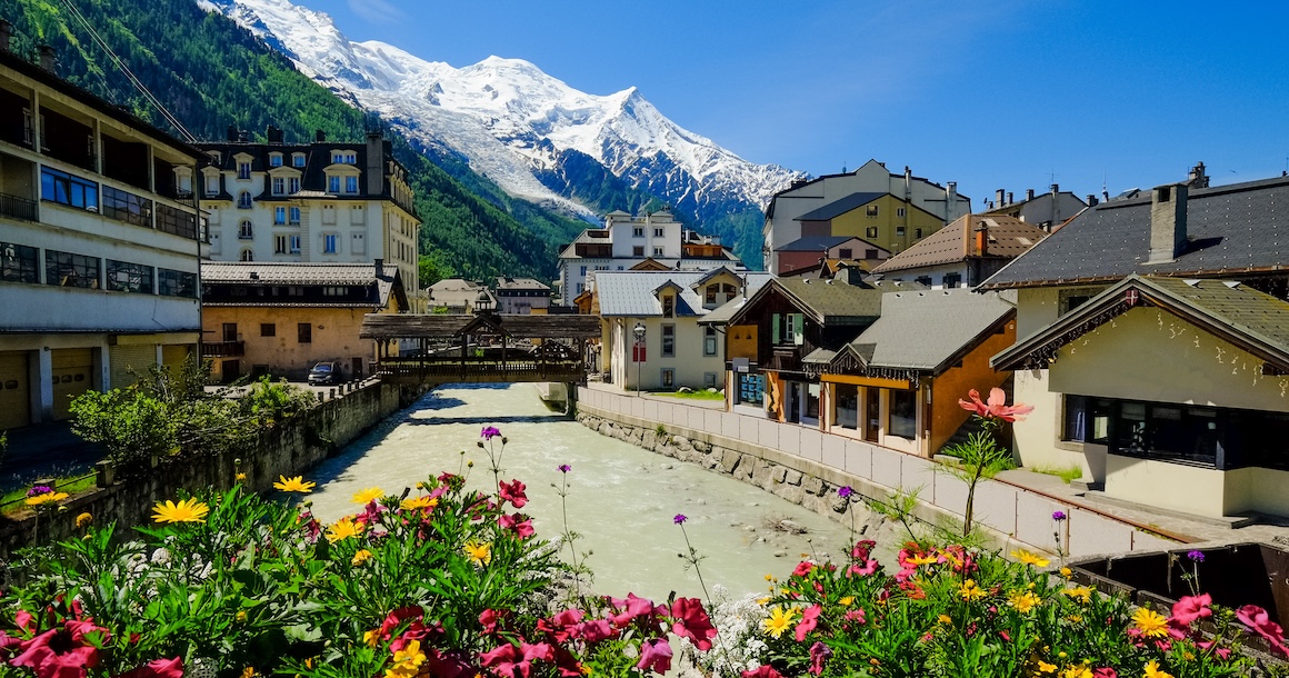
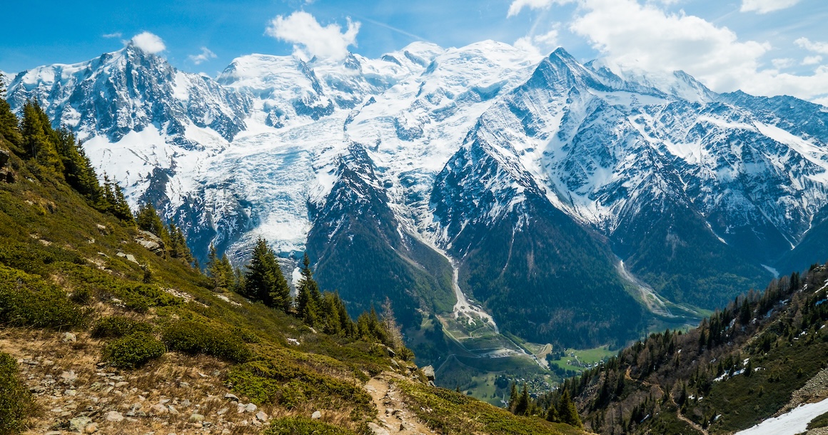
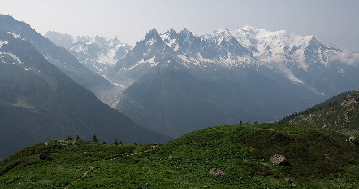
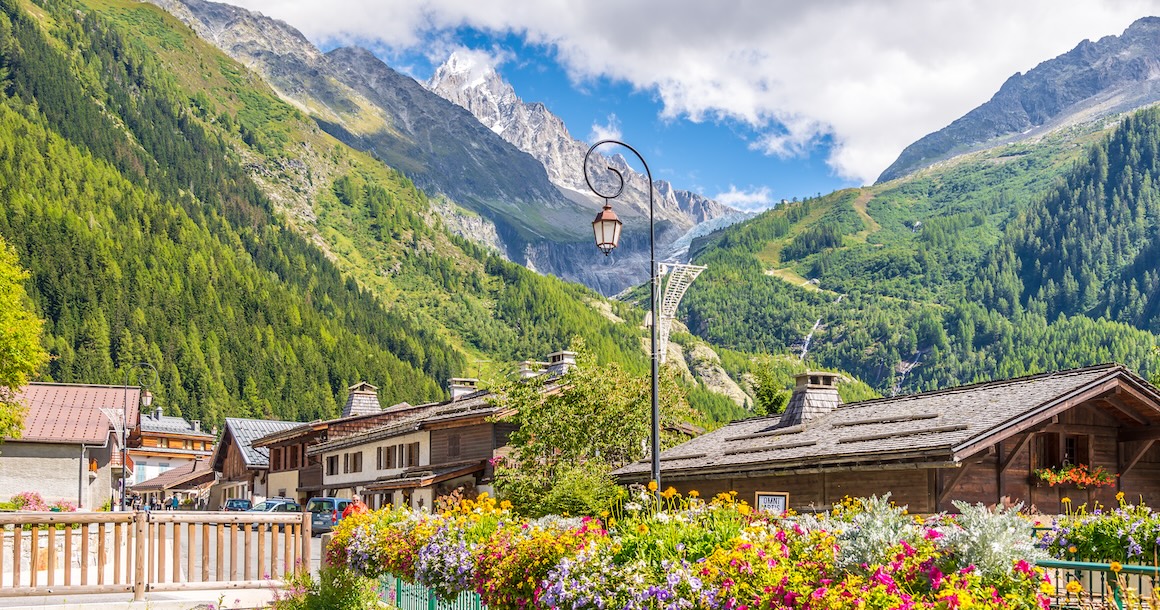
Mont Blanc (15,781 feet) rises more than 12,000 vertical feet above the famous resort village of Chamonix, France. The epitome of everything that is “alpine” in the Alps, Mont Blanc beckons hikers and climbers from around the globe with its snow-white glaciers, sheer cliff walls, and chalet-studded valleys.
To relax at a chic café in downtown Chamonix, gazing skyward at the glistening ramparts of the Mont Blanc Massif, is an amazing experience. To walk around the entire circumference of Western Europe’s tallest peak, and to witness Mont Blanc’s beauty from the vantages of three different countries, is something all together incomparable and infinitely special.
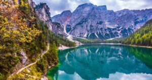
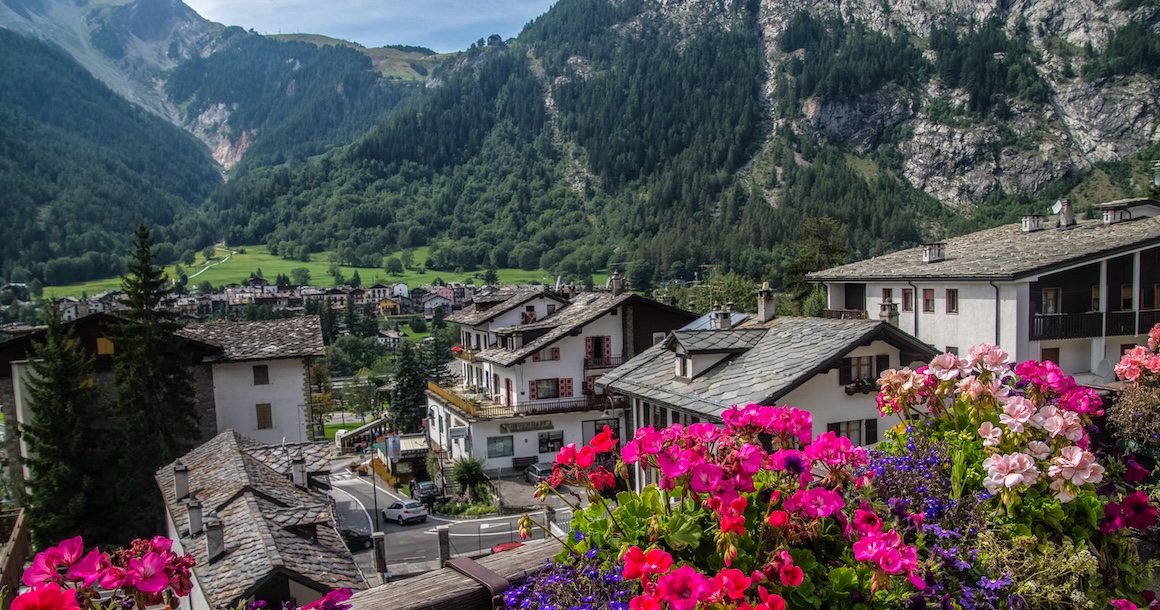
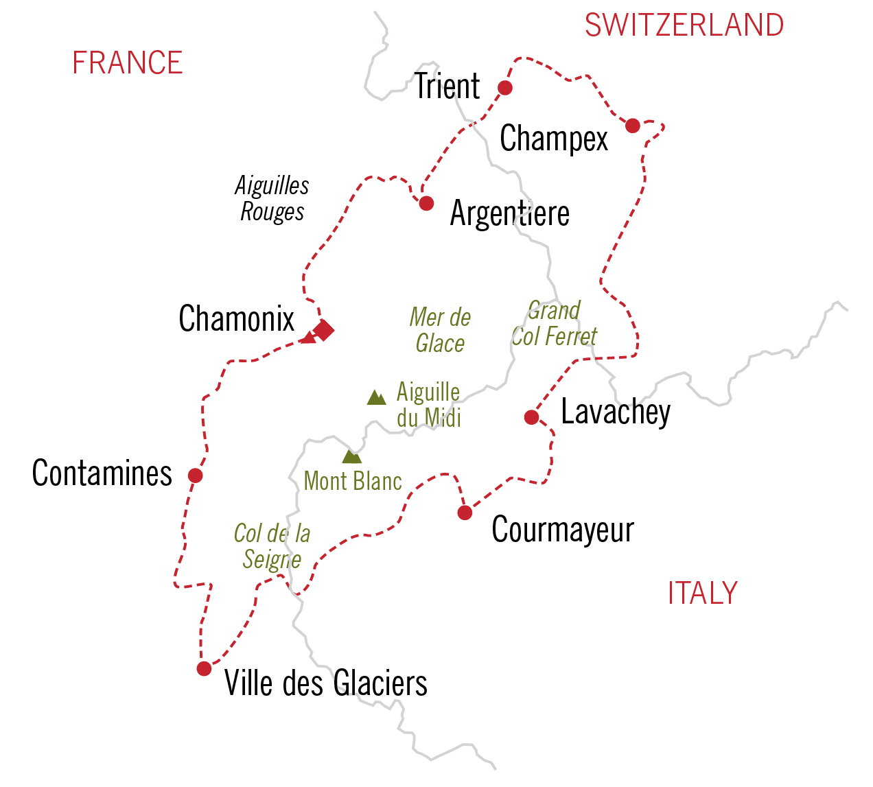
Hike across the borders of France, Italy and Switzerland during our ten-day self-guided hiking tour. Taking advantage of some little-known variations to the standard route, you hike from the mountain-chic cafés of Chamonix, to remote mountain hamlets en route to Courmayeur, Italy. Our gracious host welcomes you to her cozy chalet in Champex, Switzerland, tempting you with locally grown food and delicious wine. Hike back into France on the Grand Balcon Sud, one of the most beautiful hiking trails in all of France.
Based out of a mix of charming country inns, first-class, old world hotels and simple hiker’s hostelries, the unique combination of a variety of accommodations and spectacular hiking makes this trek a wonderful reward for the physically fit. You’ll be pampered at our first-class hotels and experience the more rugged side of the hike with our simple hostelries which have shared facilities and simple fare.
Trip Elevation

Trip Itinerary
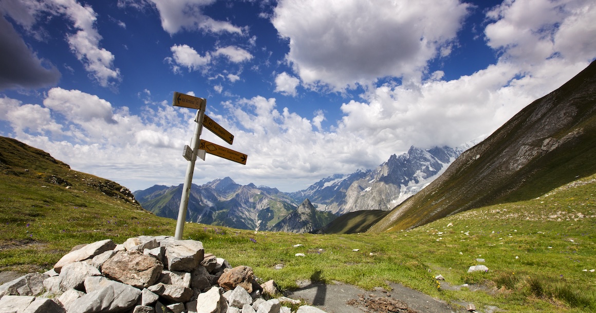
Choose from our standard itinerary or customize the trek by adding or subtracting days.
Independently transfer to Chamonix, located at the base of Western Europe’s tallest peak, Mont Blanc – 15,781 ft. Geneva is the recommended point of entry.
Shuttle from Chamonix to Les Houches in the morning and enjoy a moderate introductory hike to Contamines, with views over the peaks and glaciers of Chamonix. Hike past old ruins and settlements, then over the Col de Tricot, where you descend through a splendid forest to Les Contamines.
Distance: 9.5 miles. Elevation gain/loss: 2000/4000 ft
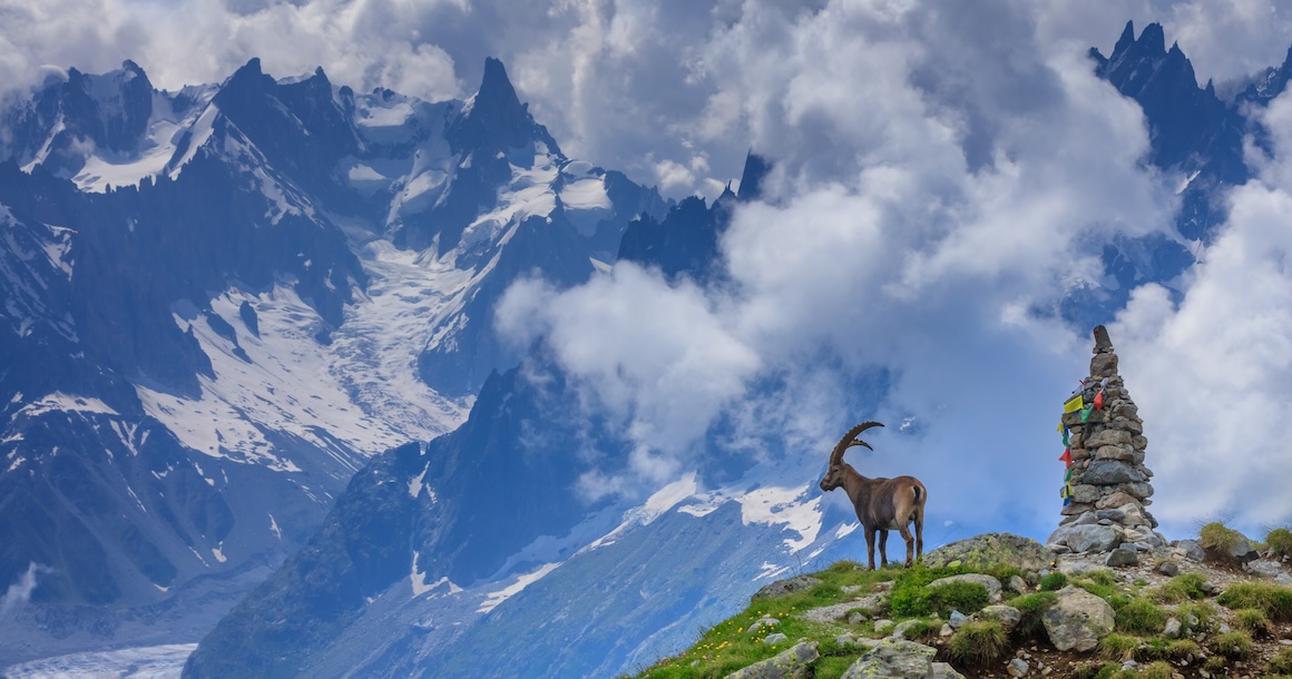
Ascend past waterfalls on an ancient Roman road to the dramatically situated Refuge de la Croix du Bonhomme. A delightful descent through high alpine meadows offers opportunity to spot the elusive ibex. You spend the night in a simple, but charming mountain inn. Private rooms are subject to availability.
Distance: 12 miles. Elevation gain/loss: up to 4300/2950 ft
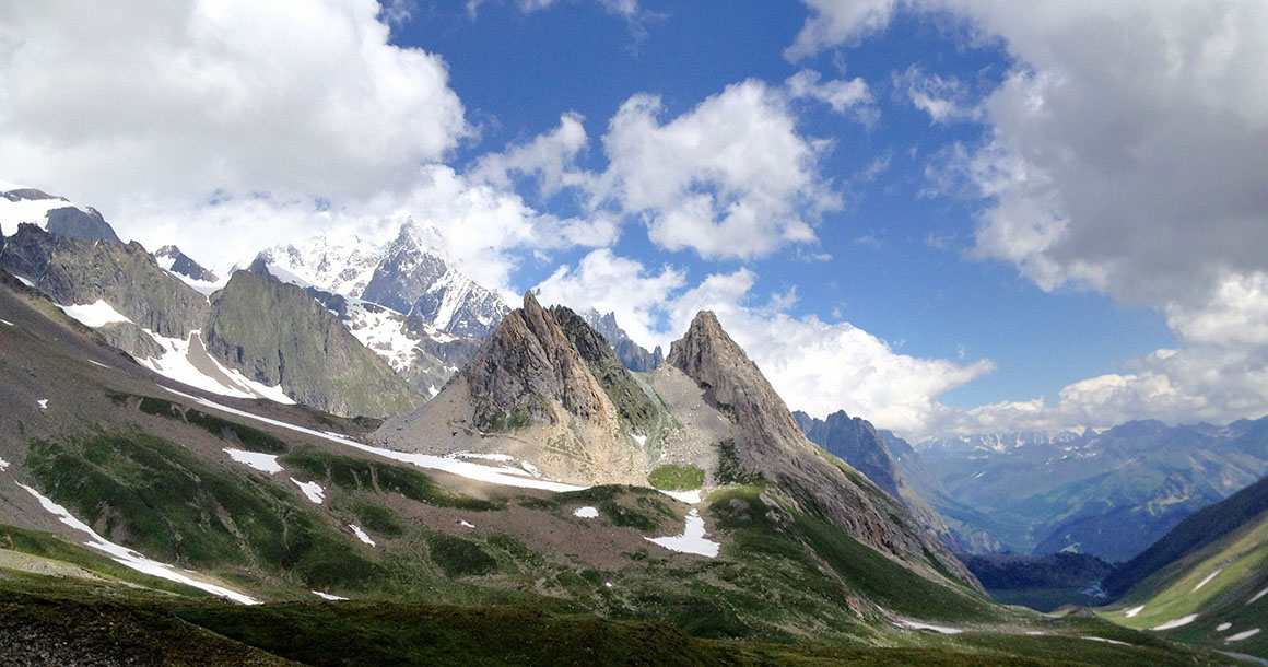
The greetings change to Italian today as you cross the border to Italy at the Col de la Seigne. Enjoy staggering views of the glaciated peaks on the Italian side of Mont Blanc.
Distance: 8.5 miles. Elevation gain/loss: 2400/2870 ft.
Extension: 12 miles. Elevation gain/loss: 2400/3250 ft.
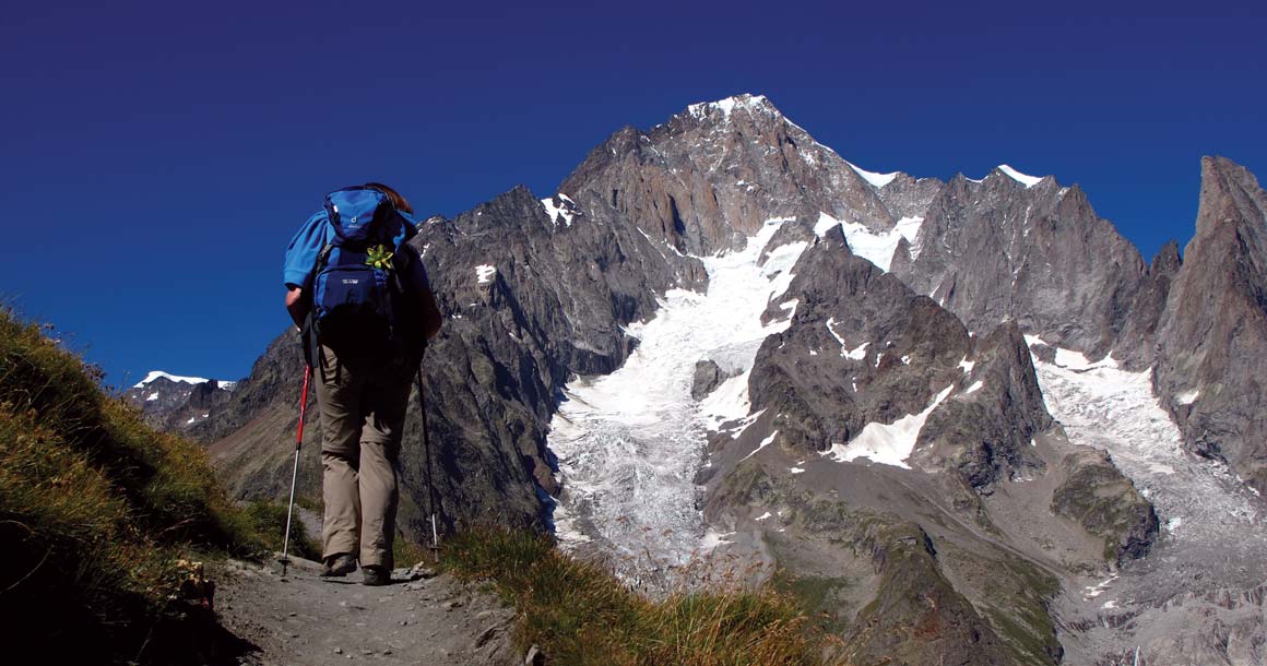
As you traverse from Courmayeur to Val Ferret, across Mont de la Saxe, you are treated to ever-improving views of the Brenva face of Mont Blanc, its most impressive and imposing aspect on our remote, rarely traveled variation.
Distance: 11 miles. Elevation gain/loss: 3300/2100 ft.
The language changes back to French as you ascend the Grand Col Ferret into the canton of Valais in Switzerland. Stunning views of the Grand Combin massif make this a spectacular hike. Descend through pristine meadows to the Swiss Val Ferret. At the end of the hike there is a short transfer to the idyllic lakeside town of Champex.
Distance: 11.5 miles. Elevation gain/loss: 2600/3100 ft.
Today you hike into the gorgeous side valley of Le Barmey and stop for lunch at Alpage de Bovine hut, above the beautiful Rhone Valley. Your route ends in Trient, where you stay in a simple mountain hostel with shared bathrooms. Private rooms are subject to availability. You have access to your luggage here.
Distance: 10 miles. Elevation gain/loss: 2400 ft.
From Trient, hike via the Col des Posettes. Today is a pleasant, and not particularly strenuous stage of the TMB that offers unbelievable views of the Aiguilles and Mont Blanc. Following a picnic or hut lunch, travel down into the valley to Le Tour and onto Argentière.
Distance: 9 miles. Elevation gain/loss: 2500/2700 ft.
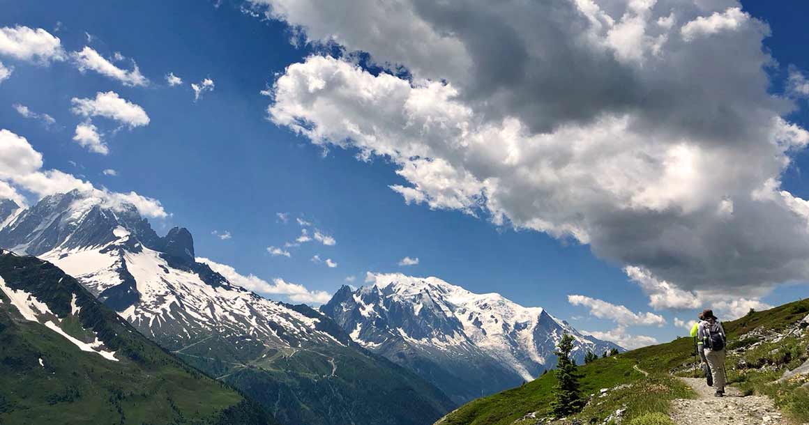
This hike along the stunning Grand Balcon Sud offers spectacular views of Mont Blanc and the Aiguilles, or needles, of Chamonix.
Distance: 7 – 9.5 miles. Elevation gain/loss: 2500 ft. Options to extend or shorten the hike are available.
Awaken to a delicious French breakfast, then depart. An early afternoon flight from Geneva can easily be met.
Similar Trips


Trip Rating
COMFORT
EFFORT
TERRAIN
Self-Guided Tour
Self Guided TMB is sold out for 2026.
For 2027, reservations are accepted for all published departure dates below. Final departure confirmation will be provided once accommodations have been secured.
June 17-26
June 20-29
June 23-July 2
June 24-July 3
July 1-10
July 2-11
July 6-15
July 8-17
July 15-24
July 18-27
July 22-31
July 25-August 3
July 26-August 4
August 2-11
August 4-13
August 6-15
August 8-17
August 12-21
August 31-September 9
September 9-18
Guided Tour
June 20-29, 2026 BOOKINGS CLOSED
July 16-25, 2026 BOOKINGS CLOSED
August 18-27, 2026 BOOKINGS CLOSED
Pricing
**$7,400 per person double
Single (+$1020)*
**A minimum of four people required to run this trip.
*Single supplements do not apply to mountain huts, where single rooms are not available.
Learn MorePrivate Guided Tour
Mid June-Mid September
Pricing
**$8,800 per person double
Single (+$1020)*
**Price based on a group of four.
*Single supplements do not apply to mountain huts, where single rooms are not available.
Please contact us to schedule a private guided tour.
Learn MoreTrip Map
Trip Profile
Duration
9 nights/10 days
Hiking up to 12 miles
Ascents up to 4500 ft
Tour Package Includes
Custom route descriptions
GPX tracks for each day hike
Four-color topo maps
Travel instructions
Cultural information
Luggage transfers: One soft-sided bag (wheels okay) per person, no more than 33 lbs/15 kg. Extra baggage will be an additional charge.
Accommodations
2 nights in first class hotels
5 nights in charming country inns
1 night in simple mountain hostel with shared bathrooms, (private rooms are subject to availability)
1 night charming simple inn / hut with shared bathrooms, (private rooms are subject to availability)
Note on Huts:Private rooms are limited and not guaranteed. They are only available for two people to share. Single rooms are not offered, and single supplements do not apply. Shared accommodations are standard, and we’ll do our best to room friends or group members together.
Breakfast + Dinner
Breakfast included daily.
Dinner included everywhere except Chamonix.
Mountain hostel and inn/hut offer traditional, no-frills meals.
Luggage Transfer
Luggage transfers are included daily.
Luggage restrictions: One soft-sided bag per person no more than 33 lbs/15 kg. Extra baggage will be an additional charge.
*$100 supplement for solo hiker.
Transportation
Taxi transfers on the standard itinerary are included during the tour starting and ending in Chamonix. Public transportation costs are not included in the trip price. If the itinerary includes public transportation, we provide timetables, schedules, and a link to purchase tickets if available.
Gateways
Geneva, Switzerland